LOS EVENTOS DE HINOJAR DEL REY
Transitar por Hinojar del Rey y su memoria.
CAMINOS DE CASTILLA, PATRIMONIO EUROPEO. EL SUR DE BURGOS. El municipio.
Walking through Hinojar del Rey and its memory.
CASTILIAN ROADS, EUROPEAN HERITAGE. THE SOUTH OF BURGOS. The municipality.
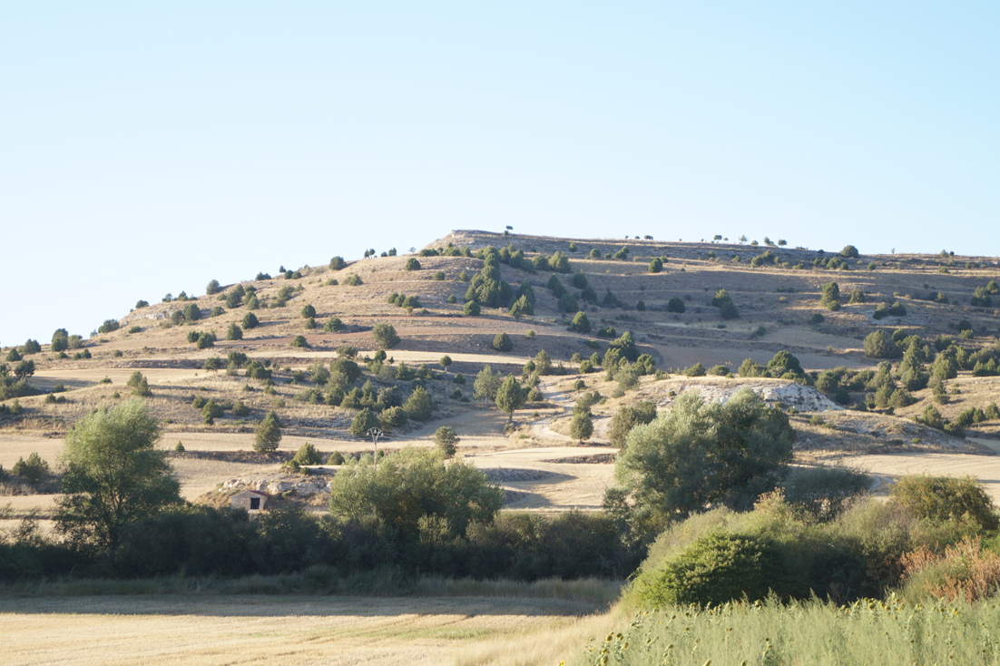
Hinojar del Rey es una pequeña e interesante población de 56 habitantes en el valle del río Espeja, Huerta del Rey, en el sur de la provincia de Burgos. Su territorio agroforestal está cruzado por múltiples vías, caminos y veredas desde época prerromana: por el Camino Real de Cuenca a Burgos, el Camino del Cid, el de la Lana, la Vía hacia el Camino de Santiago francés, etc. Es un municipio tranquilo, de peculiares construcciones tradicionales, agradables vinos y acogedores habitantes que estimulan al viajero a conversar, descubrir y disfrutar de sus bondades.
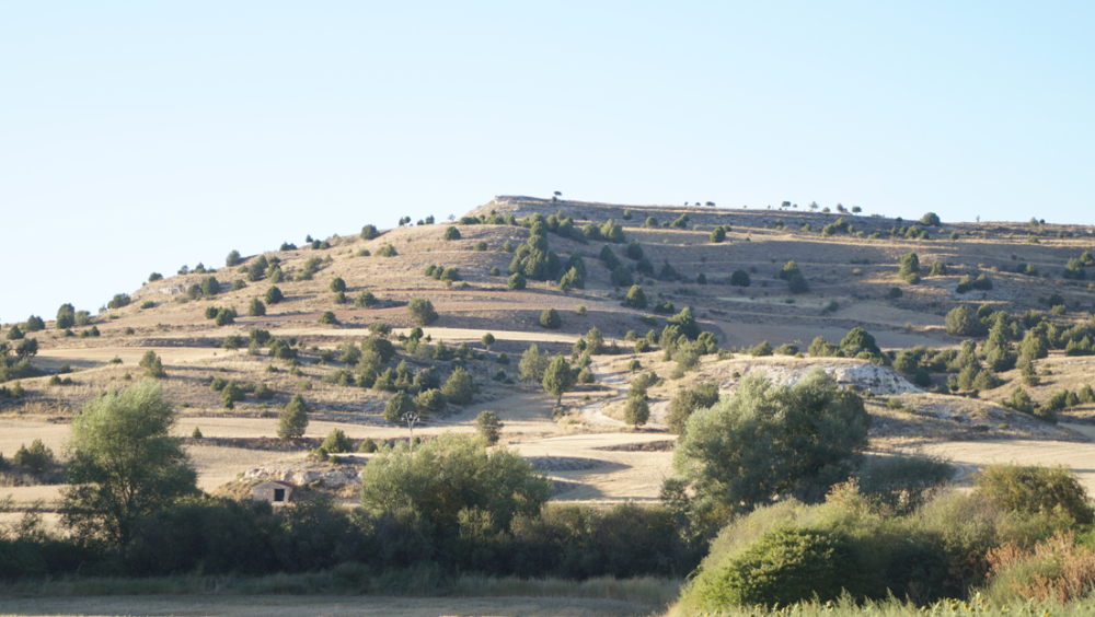
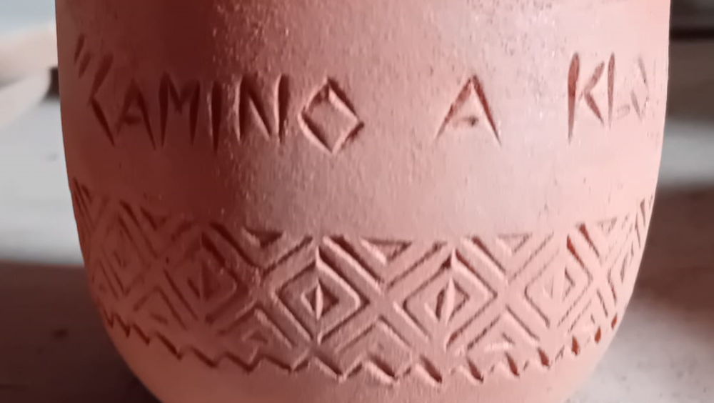
Conserva una gran riqueza natural, tradicional, patrimonial e histórica. Comparte con Quintanarraya, el perfil multiaterrazado del cerro Los Castrillos. Su complejo relieve revela la milenaria población fortificada Klounioq, de la tribu arévaca de la Edad del Hierro. Esas alturas fueron ocupadas desde el siglo IV-III a. C. Emitió moneda propia, denarios de plata y a través de ellos nos ha llegado su nombre Klounioqu, fosilizado en el s. I d. C.del municipio Clunia, en la forma latina.
Los visigodos explotaron este territorio. En 1930 se excavó un cementerio de ochenta tumbas. Los restos recuperados fueron diseminados por distintos museos de Alemania nazi para su restauración, perdiéndose el rastro de muchos. Una muestra se custodia en el Museo Arqueológico Nacional de Madrid.
De 1073 es el documento de cesión del rey Alfonso VI, de la citada como Villa de Coviellas al abad de San Sebastián de Silos, junto con su monasterio de San Pedro. En 1755, figura con el nombre lugar de Ynoj(x?)ar del Rey.
Hinojar del Rey is a small and interesting village of 56 inhabitants in the valley of the river Espeja, Huerta del Rey, in the south of the province of Burgos. Its agroforestry territory is crossed by many roads, paths and tracks since pre-Roman times: the Camino Real from Cuenca to Burgos, the Camino del Cid, the Camino de la Lana, the Vía towards the French Way of St. James, etc. It is a peaceful municipality, with peculiar traditional constructions, pleasant wines and welcoming inhabitants who encourage the traveller to converse, discover and enjoy its charms.
The Visigoths exploited this territory. In 1930 a cemetery with eighty tombs was excavated. The remains recovered were scattered to various museums in Nazi Germany for restoration, and many were lost. A sample is kept in the National Archaeological Museum in Madrid.
From 1073 is the document of cession by King Alfonso VI of the aforementioned Villa de Coviellas to the abbot of San Sebastián de Silos, together with its monastery of San Pedro. In 1755, it appears under the name of the place of Ynoj(x?)ar del Rey.
Octubre - October
Viernes 26 – Friday 26
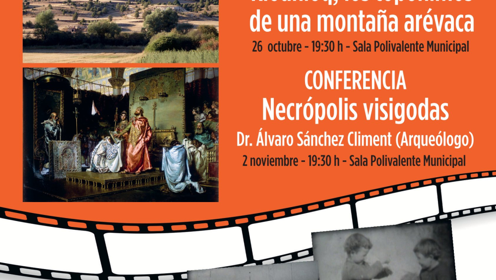
Vía HR-1, Conferencia: Presentación comentada de “Los topónimos de la montaña arévaca Los Castrillos”. Via HR-1, Lecture: Commented presentation of ‘The toponyms of the Arevacian Mountain’.
El oppidum Klounioqu en celtibérico y Clounioq en latín, fue frontera con la etnia vaccea, sufrió los asedios del ejército romano y su final es aún una incógnita arqueológica. Sin embargo, el nombre arévaco no se perdió. Quedó perpetuado en el municipio romano de Clunia bajo Tiberio, al inicio del siglo I de nuestra Era, establecido ex novo en el vecino cerro Alto de Castro.
El cerro de Los Castrillos es un área de muy alto interés patrimonial y arqueológico. Se encuentra administrativamente repartido entre dos antiguos municipios, integrados en la actualidad en un tercero que atiende a las funciones administrativas. Haber podido fijar la toponimia base, la memoria colectiva, tiene entre sus muchas virtudes ser de todos y no pertenecer a nadie y, para la arqueología, la de poder concretar las referencias esenciales. El topónimo que las identifica y describe persiste ligado a las áreas, parcelas y polígonos administrativos actuales.
La toponimia es una ciencia multidisciplinar y las referencias topográficas son una común e inadvertida forma de situarnos en nuestro espacio habitual, en nuestra área de confort o en un territorio compartido. Es la manera que nos permite ser localizados inequívocamente mediante la comunicación de un nombre propio preciso y único, de un referente físico. En el territorio que circunda los núcleos de población rango menor y decreciente las denominaciones toponímicas son precisas, naturales y con diferente rango de antigüedad. Nombres específicos que pueden haber dejado de reflejar la relación que hubo entre el referente del medio geográfico y natural con el actual. Sin embargo, siguen siendo reconocidos por los habitantes residentes pero se diluyen y pierden entre los que abandonan ese territorio. Resultando un motivo de preocupación la desaparición de cualquier tipo de riqueza tradicional.
El cambio climático, el abandono del campo, la modificación a formas de cultivo intensivas, la silvicultura extensiva, la integración de las fincas en nuevas extensiones perdiéndose la delimitación de las parcelas originales y la normalización administrativa, pueden ser causas de la aceleración de la pérdida o translocación de la toponimia habitual. Los cerros y colinas más abruptos pueden fosilizar con mayor facilidad los topónimos tradicionales en las comarcas en las que la reforestación no tenga gran incidencia o en las que la protección de Bienes Culturales declarados, como los yacimientos arqueológicos, limiten el cambio por la gran afectación patrimonial que suponen.
The memory and interest of two neighbours of Hinojar del Rey and Quintanarraya (Huerta de Rey, Burgos, Spain) has made it possible to draw up this first map with the basic toponyms and hydronyms of a common and relevant part of their municipalities. This is the hill Los Castrillos, where a western tribe of the Arevaci ethnic group settled in the Iron Age. A very large fortress habitat from at least the end of the 4th century BC and the beginning of the 3rd century BC. An oppidum, named Klounioqu in Celtiberian and Clounioq in Latin. It was a frontier with the Vaccaei ethnic group, was besieged by the Roman army and its end is still unknown to archaeology. However, the Arevacian name was not lost. It was perpetuated in the Roman municipality of Clunia under Tiberius, at the beginning of the 1st century AD, established ex novo on the neighbouring hill Alto de Castro.
The hill of Los Castrillos is an area of great archaeological and heritage interest. It is administratively shared between two former municipalities, now integrated into a third one that serves administrative functions. One of the many virtues of having been able to fix the basic toponymy, the collective memory, is that it equally belongs to everyone and no one and, for archaeology, that of being able to specify the essential references. The toponym that identifies and describes them remains linked to current administrative areas, plots and polygons.
Toponymy is a multidisciplinary science and topographical references are a common and unnoticed way of situating ourselves in our usual space, in our comfort zone or in a shared territory. It is the way that allows us to be unequivocally located in a place by communicating a proper name, precise and unique, of a physical reference. In the territory surrounding the population centres, in those of lower and decreasing rank, the toponymic names are precise, natural and of varying antiquity. Specific names that may no longer reflect the relationship that existed between the geographical and natural environment and the current one. However, they are still recognised by the resident inhabitants but are diluted and lost among those who leave the territory. The disappearance of any traditional wealth is a cause for concern.
Climate change, the abandonment of the countryside, the change to intensive forms of cultivation, extensive forestry and the integration of plots into new extensions, losing the delimitation of the original plots and the administrative standardisation may be causes of the acceleration of the loss or translocation of the usual toponymy. The steeper hills can more easily fossilise the traditional toponyms in regions where reforestation does not have a great impact or where the protection of declared cultural assets, such as archaeological sites, limits the drastic change due to the great heritage impact they represent.
Sábado 26 – Saturday 26 (matinal - in the morning)
Visita guiada: Vía IV y HR-2, El oppidum de Klounioq, Hinojar del Rey y Quintanarraya, Caminos de Castilla, sur de Burgos. Guided visit: Vía IV y HR-2, The oppidum of Klounioq. Hinojar del Rey and Quintanarraya, Burgos. Ways of Castilla, south of Burgos
Una visita guiada, un recorrido por el asentamiento indígena del siglo IV al I a. C. del que adopto su nombre la Colonia Clunia Sulpicia en el s. I d. C. Un paseo en el que descubrir una población arévaca que espera poder contar sus vicisitudes a los arqueólogos y recuperar su lugar en la historia.
A guided tour, a journey through the indigenous settlement from the 4th to the 1st century B.C. from which the Colonia Clunia Sulpicia took its name in the 1st century A.D. A walk in which to discover an Arevacan population that hopes to be able to tell archaeologists about its vicissitudes and recover its place in history.
D. Luis Valdés, es doctor en Prehistoria, Historia Antigua y Arqueología, Académico correspondiente de la Real Academia de la Historia, Preside la Asociación de Estudios de la Antigüedad y el Paleoambiente, Denboraren argia (D-argia).
Sábado 26 – Saturday 26 (matinal - in the morning)
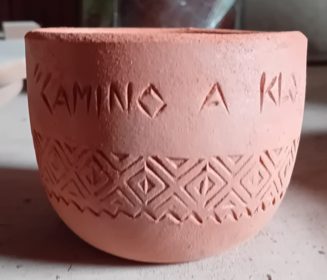
Conferencia sobre taller de investigación cerámica. Vía I transversal del Camino de la Calma a la Vía IV-HR-2 El oppidum de Klounioq. Hinojar del Rey y Quintanarraya, Burgos. Conference on ceramic research workshop. Via I transversal from Camino de la Calma to Via IV-HR-2 The oppidum of Klounioq. Hinojar del Rey and Quintanarraya, Burgos.
A pocos kilómetros del inicio del Camino de la Calma en el Monumental monasterio de la Vid dirección a Peñaranda de Duero, se abre un centro ceramista denominado A Cántaros. Un lugar de recomendada visita por su calidad y el calor de sus propietarios: Maite Palacios y José Palacio.
Con su labor inquieta y meticulosa, aportan formación y explicación sobre los procedimientos de elaboración de objetos cerámicos históricos de gran atractivo. Son entusiastas del mundo arqueológico, como se observa en sus elaboradas producciones. Su trabajo hace que sean un motivo de esta Vía transversal, entre dos caminos relevantes. Una oferta de descanso, tranquilo y personal, para vías activas pero no masificadas. Una visita imperecedera y cercana.
Se va a presentar el resultado del estudio y reproducción de un elemento muy útil, propio de la elaboración de prendas de lana. Un objeto que hoy es pieza de museo etnográfico, resultado de compensar hábilmente las necesidades cotidianas desde un tiempo al que no podemos darle fecha. Don José Palacio ofrecerá una explicación tanto de carácter etnográfico como del trabajo desarrollado en su alfar.
Conferenciante: D. José Palacio Cantos, ceramista.
A few kilometres from the beginning of the Camino de la Calma in the Monumental Monastery of La Vid in the direction of Peñaranda de Duero, there is a ceramics centre called A Cántaros. A place to visit for its quality and the warmth of its owners: Maite Palacios and José Palacio.
With their restless and meticulous work, they provide training and explanations on the production processes of highly attractive historical ceramic objects. They are enthusiastic about the archaeological world, as can be seen in their elaborate productions. Their work makes them a motif of this Via transversal, between two relevant paths. An offer of rest and relaxation, quiet and personal, for active but not overcrowded routes. An everlasting and close visit.
The result of the study and reproduction of a very useful element, typical of the production of woollen garments, will be presented. An object that today is an ethnographic museum piece, the result of skilfully compensating for everyday needs from a time to which we cannot give a date. José Palacios will give an explanation of both the ethnographic character and the work carried out in his pottery.
Lecturer: Mr. José Palacio Cantos, ceramist
Noviembre – November
Sábado 2 – Saturday 2
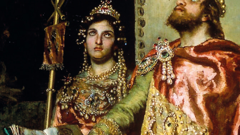
Conferencia: HR-3, Necrópolis visigodas. HR-3, Visigothic Necropolises.
En esta tarde abordaremos las prácticas funerarias de la época visigoda (siglos V-VIII), un tema crucial para comprender la cultura y espiritualidad de este pueblo germánico asentado en la península ibérica. El análisis se centrará en los cambios y continuidades en las costumbres funerarias desde su llegada hasta la consolidación del reino visigodo en Hispania, destacando la interacción entre las tradiciones germánicas y el cristianismo.
Examinaremos las principales características de los ritos funerarios visigodos, como es la estructura de las tumbas, la disposición de los cuerpos y la presencia de ajuares funerarios. Asimismo, se exploraremos la evolución desde los enterramientos simples con influencia germánica hasta prácticas más complejas, con la inclusión de símbolos cristianos, reflejo del proceso de conversión religiosa que vivió el reino visigodo.
El estudio arqueológico de necrópolis visigodas, como las de Castiltierra, El Carpio de Tajo, Hinojar del Rey o La Ermita de la Vega, será clave para ilustrar estos cambios, permitiéndonos interpretar cómo los visigodos manifestaban sus creencias sobre la muerte y el Más Allá. La conferencia también abordará la importancia social y política de las prácticas funerarias.
Concluiremos con una reflexión sobre cómo el estudio de estas prácticas nos ayuda a entender la compleja relación entre identidad, religión y poder en la Hispania visigoda.
This afternoon we will discuss the funerary practices of the Visigothic period (5th-8th centuries), a crucial topic for understanding the culture and spirituality of this Germanic people settled in the Iberian Peninsula. The analysis will focus on the changes and continuities in funeral customs from their arrival to the consolidation of the Visigothic kingdom in Hispania, highlighting the interaction between Germanic traditions and Christianity.
We will examine the main characteristics of Visigothic funeral rites, such as the structure of the tombs, the arrangement of the bodies, and the presence of funerary goods. Additionally, we will explore the evolution from simple burials with Germanic influence to more complex practices, including Christian symbols, reflecting the religious conversion process experienced by the Visigothic kingdom.
The archaeological study of Visigothic necropolises, such as those of Castiltierra, El Carpio de Tajo, Hinojar del Rey, or La Ermita de la Vega, will be key to illustrating these changes, allowing us to interpret how the Visigoths expressed their beliefs about death and the afterlife. The lecture will also address the social and political significance of funerary practices.
We will conclude with a reflection on how the study of these practices helps us understand the complex relationship between identity, religion, and power in Visigothic Hispania.
D. Álvaro Sánchez Climent, es doctor en el programa Estudios del Mundo Antiguo; Diploma de estudios avanzados (DEA); Profesor-conferenciante en el departamento de Historia, Campus de Ciudad Real, Universidad de Castilla-La Mancha. Profesor de Historia E.M.
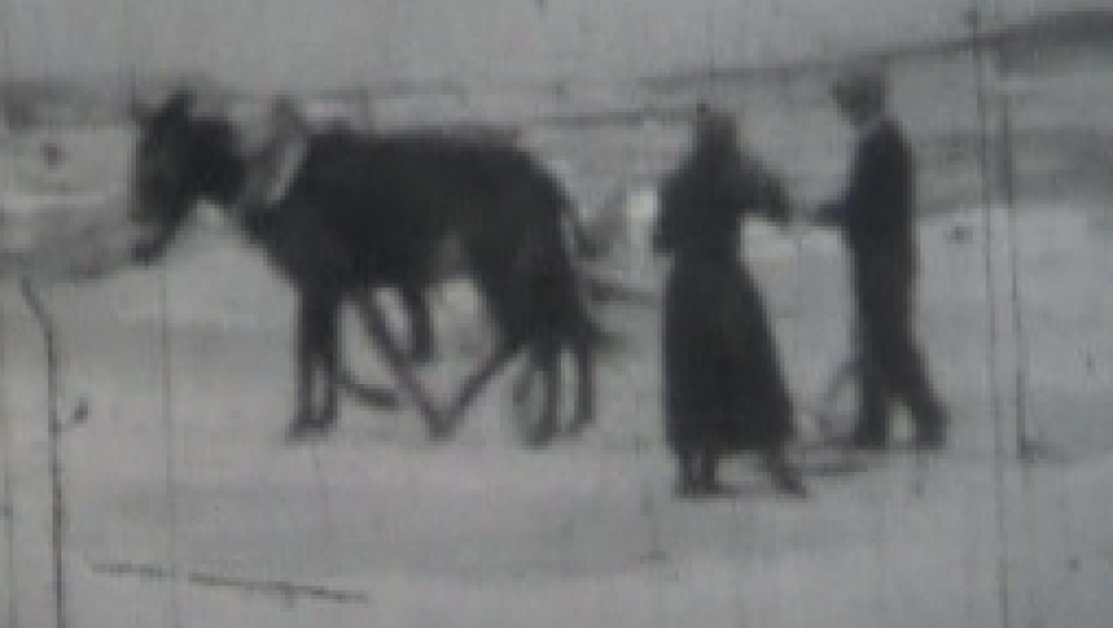
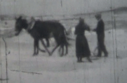
Vía HR-4, MEMORIA CINEMATOGRÁFICA: HINOJAR DEL REY EN 8 Y 8,5 mm – Via HR-4, CINEMATOGRAPHIC MEMORIES: HINOJAR DEL REY IN 8 AND 8.5 mm
Se anunciarán la Sala de exhibición, las fechas y la hora de las visualizaciones.- The Exhibition Hall, dates and time of viewings will be announced
Hinojar del Rey cuenta con un documento cinematográfico de los años 50 hasta los 70, centrado en actividades del pueblo. Preserva prácticas cotidianas, familiares, ceremonias sacras, agrícolas, lúdicas como el campeonato de pelota mano o vasca, el acondicionamiento de una carretera, etc. Este documento ha sido digitalizado y se le han añadido canciones de gran interés
Hinojar del Rey has a film document from the 1950s to the 1970s, focusing on village activities. It preserves daily and family practices, sacred ceremonies, agricultural and recreational ceremonies such as the Basque pelota championship, the construction of a road, etc. This document has been digitised and songs of great interest have been added.
Adresse
Calle Dos de Mayo 11, 09454 , Espagne